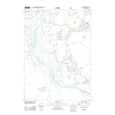
2012 Map of Jackson
USGS Topo · Published 2012About this map
Jackson and its surrounding mountain landscape appear in high detail during the early 2010s, showing the town's footprint just north of the steep slopes of Snow King Mountain. The survey captures a high-mountain valley where the braided channels of the Snake River dominate the lowlands, creating a complex network of wetlands and seasonal watercourses. Local aviation is represented by the Fish Creek Landing Strip to the west and the Melody Ranch Airport to the south, highlighting the region's reliance on air travel for mountain access.
Find a feature on this map
110 named features on this map. Tap any name to fly to it.
Don’t see what you’re looking for? This feature index may not catch every label — zoom into the map to look around manually.
Map Details
Editions of this 2012 Jackson Map
This is the sole edition of this map. No revisions or reprints were ever made.
Other maps of this area

1899 · Grand Teton
USGS Topo · 1:125,000

1901 · Grand Teton
USGS Topo · 1:125,000

1931 · Jackson
USGS Topo · 1:125,000

1935 · Jackson
USGS Topo · 1:125,000

1955 · Driggs
USGS Topo · 1:250,000

1958 · Driggs
USGS Topo · 1:250,000

1962 · Driggs
USGS Topo · 1:250,000

1963 · Munger Mountain
USGS Topo · 1:24,000

1963 · Jackson
USGS Topo · 1:24,000

1963 · Teton Pass
USGS Topo · 1:24,000