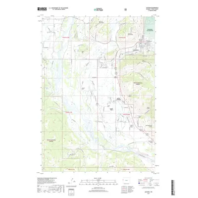
2017 Map of Jackson
USGS Topo · Published 2017About this map
West Gros Ventre Butte and East Gros Ventre Butte rise above the valley floor, framing the northern approaches to Jackson. This 2017 study illustrates the dense residential grid of the town, centered around Saint John's Episcopal Church and the High School, while showing the expanding footprint of outlying communities like South Park and Melody Ranch. The landscape is dominated by the Snake River corridor and the protected expanses of the National Elk Refuge and Teton National Forest. Local landmarks such as Aspen Hill Cem and Josies Ridge provide specific points of reference for genealogists and local historians tracking the modern layout of the valley. Significant canyons, including Wilson Canyon and Horsethief Canyon, mark the transition from the valley floor to the surrounding heights of Snow King Mtn and Munger Mountain.
Find a feature on this map
114 named features on this map. Tap any name to fly to it.
Don’t see what you’re looking for? This feature index may not catch every label — zoom into the map to look around manually.
Map Details
Editions of this 2017 Jackson Map
This is the sole edition of this map. No revisions or reprints were ever made.
Other maps of this area

1899 · Grand Teton
USGS Topo · 1:125,000

1901 · Grand Teton
USGS Topo · 1:125,000

1931 · Jackson
USGS Topo · 1:125,000

1935 · Jackson
USGS Topo · 1:125,000

1955 · Driggs
USGS Topo · 1:250,000

1958 · Driggs
USGS Topo · 1:250,000

1962 · Driggs
USGS Topo · 1:250,000

1963 · Munger Mountain
USGS Topo · 1:24,000

1963 · Jackson
USGS Topo · 1:24,000

1963 · Teton Pass
USGS Topo · 1:24,000