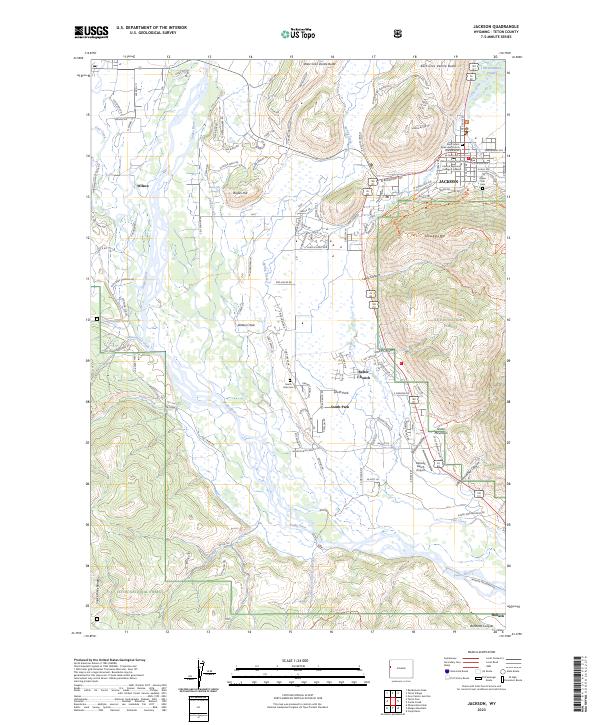
2023 Map of Jackson
USGS Topo · Published 2023About this map
The Snake River winds through the heart of the Jackson Hole valley, defining a landscape shaped by both protected wildlands and modern community development. On the eastern edge of the valley, the National Elk Refuge and the slopes of Snow King Mtn provide a dramatic backdrop for the town of Jackson. The town itself is a hub of civic activity, anchored by the Teton County Courthouse and Central Wyoming College-Jackson. Local heritage is preserved at sites like Saint John's Episcopal Church Columbarium and Aspen Hill Cem. Southward, the valley floor transitions into residential enclaves such as South Park and Rafter J Ranch, while the Snake River Range rises to the west near the village of Wilson. The mapping of diverse trail systems like Josies Ridge Trl and Big Munger Trl illustrates the region's focus on outdoor access within the Teton National Forest.
Find a feature on this map
58 named features on this map. Tap any name to fly to it.
Don’t see what you’re looking for? This feature index may not catch every label — zoom into the map to look around manually.
Map Details
Editions of this 2023 Jackson Map
This is the sole edition of this map. No revisions or reprints were ever made.
Other maps of this area

1899 · Grand Teton
USGS Topo · 1:125,000

1901 · Grand Teton
USGS Topo · 1:125,000

1931 · Jackson
USGS Topo · 1:125,000

1935 · Jackson
USGS Topo · 1:125,000

1955 · Driggs
USGS Topo · 1:250,000

1958 · Driggs
USGS Topo · 1:250,000

1962 · Driggs
USGS Topo · 1:250,000

1963 · Munger Mountain
USGS Topo · 1:24,000

1963 · Jackson
USGS Topo · 1:24,000

1963 · Teton Pass
USGS Topo · 1:24,000