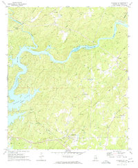
1971 Map of Jacksons Gap
USGS Topo · Published 1974About this map
Martin Lake and the winding course of the Tallapoosa River dominate this landscape in eastern Alabama, where the rising waters have reshaped the topography around Peters Island and Irwin Shoals. The area is marked by a legacy of transportation and rural community life, featuring the Central of Georgia railroad line alongside an Old Railroad Grade that speaks to shifting infrastructure. Small settlements like Fosheeton and Tohopeka are scattered among the ridges and creek valleys.
Find a feature on this map
44 named features on this map. Tap any name to fly to it.
Don’t see what you’re looking for? This feature index may not catch every label — zoom into the map to look around manually.
Map Details
Editions of this 1971 Jacksons Gap Map
2 editions found
Other maps of this area

1891 · Ashland
USGS Topo · 1:125,000

1906 · Dadeville
USGS Topo · 1:125,000

1953 · Atlanta
USGS Topo · 1:250,000

1955 · Phenix City
USGS Topo · 1:250,000

1957 · Phenix City
USGS Topo · 1:250,000

1957 · Atlanta
USGS Topo · 1:250,000

1958 · Phenix City
USGS Topo · 1:250,000

1958 · Atlanta
USGS Topo · 1:250,000

1969 · New Site
USGS Topo · 1:24,000
1969 · Hackneyville
USGS Topo · 1:24,000