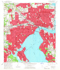
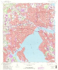
1964 Map of Jacksonville
USGS Topo · Published 1966About this map
The St Johns River serves as the central anchor for this mid-1960s urban landscape, where the confluence with the Ortega River creates a complex shoreline of points and basins. The city's growth is evidenced by a dense grid of neighborhoods like Riverside, Springfield, and San Marco, connected by major infrastructure including the Fuller Warren Bridge and Mathews Bridge. Industrial activity and transport logistics concentrate along the riverbanks, notably at the Municipal Terminal and the St Johns River Terminal.
Find a feature on this map
141 named features on this map. Tap any name to fly to it.
Don’t see what you’re looking for? This feature index may not catch every label — zoom into the map to look around manually.
Map Details
Editions of this 1964 Jacksonville Map
5 editions found
Other maps of this area

1917 · Orange Park
USGS Topo · 1:62,500

1917 · Cambon
USGS Topo · 1:62,500

1918 · Middleburg
USGS Topo · 1:62,500

1918 · Cambon
USGS Topo · 1:62,500

1918 · Jacksonville
USGS Topo · 1:62,500

1918 · Orange Park
USGS Topo · 1:62,500

1941 · Middleburg
USGS Topo · 1:62,500

1948 · Jacksonville
USGS Topo · 1:250,000

1948 · Eastport
USGS Topo · 1:24,000

1949 · Jacksonville Heights
USGS Topo · 1:24,000
Featured Places
- Jacksonville, FL
- Lake Shore, Jacksonville
- Pearl Court, Jacksonville
- Saint Nicholas, Jacksonville
- Larsen, Jacksonville