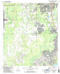
1993 Map of Jacksonville Heights
USGS Topo · Published 1993About this map
US Naval Air Station (Cecil Field) dominates the western landscape of this Clay County and Duval County border region, characterized by restricted zones and aviation infrastructure. To the east, the suburban growth of Jacksonville Heights and Oak Hill is evident, organized around corridors like 103d Street and Blanding Blvd. The map captures a transition from military and industrial use—marked by numerous sandpits—to established residential neighborhoods such as Ridgewood and Argyle Forest. Local life is anchored by community landmarks including Jacksonville Heights School and N B Forrest High School, alongside several neighborhood congregations like Oak Crest Ch. In the south, the terrain softens toward the water as Little Black Creek flows toward Doctors Lake at Sugarhouse Cove, while the Seaboard System railroad and an Old Railroad Grade trace the legacy of regional transport through the pine lands.
Find a feature on this map
55 named features on this map. Tap any name to fly to it.
Don’t see what you’re looking for? This feature index may not catch every label — zoom into the map to look around manually.
Map Details
Editions of this 1993 Jacksonville Heights Map
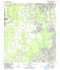
2 editions found
Other maps of this area

1917 · Orange Park
USGS Topo · 1:62,500

1917 · Cambon
USGS Topo · 1:62,500

1918 · Middleburg
USGS Topo · 1:62,500

1918 · Cambon
USGS Topo · 1:62,500

1918 · Jacksonville
USGS Topo · 1:62,500

1918 · Orange Park
USGS Topo · 1:62,500

1941 · Middleburg
USGS Topo · 1:62,500

1948 · Jacksonville
USGS Topo · 1:250,000

1949 · Middleburg SW
USGS Topo · 1:24,000

1949 · Fiftone
USGS Topo · 1:24,000
Featured Places
- Jacksonville, FL
- Oak Hill, Jacksonville
- Westwood, Jacksonville
- Oak Hill Park, Jacksonville
- Ridgewood, FL