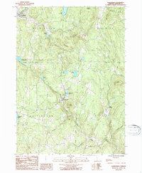
1987 Map of Jacksonville
USGS Topo · Published 1987About this map
Jacksonville and Wilmington anchor this study of the southern Vermont hills during the late twentieth century. The landscape is defined by its significant water bodies, including the northern reach of Harriman Reservoir and several smaller upland pools like Lake Raponda and Spruce Lake. The terrain rises sharply to summits such as Hogback Mountain and Mt Olga, the latter of which is contained within the protected boundaries of Molly Stark State Park.
Find a feature on this map
32 named features on this map. Tap any name to fly to it.
Don’t see what you’re looking for? This feature index may not catch every label — zoom into the map to look around manually.
Map Details
Editions of this 1987 Jacksonville Map
2 editions found
Other maps of this area

1886 · Hawley
USGS Topo · 1:62,500

1889 · Wilmington
USGS Topo · 1:62,500

1890 · Hawley
USGS Topo · 1:62,500

1890 · Greenfield
USGS Topo · 1:62,500

1891 · Wilmington
USGS Topo · 1:62,500

1891 · Brattleboro
USGS Topo · 1:62,500

1893 · Brattleboro
USGS Topo · 1:62,500

1894 · Greenfield
USGS Topo · 1:62,500

1894 · Hawley
USGS Topo · 1:62,500

1899 · Wilmington
USGS Topo · 1:62,500