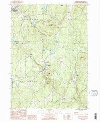
1987 Map of Jacksonville
USGS Topo · Published 1987About this map
Jacksonville sits at the heart of this Southern Vermont landscape, where the East Branch North River and the West Branch meet. The terrain is defined by significant ridges like Hogback Mountain and Mt Olga, the latter preserved within Molly Stark State Park. To the west, the massive Harriman Reservoir occupies the Deerfield River valley, contrasting with the smaller, natural water bodies that dot the highlands, such as Lake Raponda and Sadawga Lake. The 1980s settlement pattern reflects a mix of clustered village centers and dispersed upland homesteads, with local history preserved in various Cem locations. The map captures the intersection of four towns—Wilmington, Marlboro, Whitingham, and Halifax—detailing a network of brooks and improved roads that follow the contours of Stickney Hill and Blue Mountain.
Find a feature on this map
36 named features on this map. Tap any name to fly to it.
Don’t see what you’re looking for? This feature index may not catch every label — zoom into the map to look around manually.
Map Details
Editions of this 1987 Jacksonville Map
2 editions found
Other maps of this area

1886 · Hawley
USGS Topo · 1:62,500

1889 · Wilmington
USGS Topo · 1:62,500

1890 · Hawley
USGS Topo · 1:62,500

1890 · Greenfield
USGS Topo · 1:62,500

1891 · Wilmington
USGS Topo · 1:62,500

1891 · Brattleboro
USGS Topo · 1:62,500

1893 · Brattleboro
USGS Topo · 1:62,500

1894 · Greenfield
USGS Topo · 1:62,500

1894 · Hawley
USGS Topo · 1:62,500

1899 · Wilmington
USGS Topo · 1:62,500