
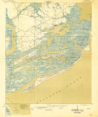
1919 Map of James Island
USGS Topo · Published 1919About this map
James Island's intricate network of tidal creeks and marshland is captured in this 1918 survey, just as the local landscape began to shift toward twentieth-century development. Settlements like Centerville, Riverland, and Secessionville are connected by the historic Kings Road, which winds past the Payne Chapel and through rural stretches like Wolfpit. The map highlights the island's coastal reliance, showing small communities such as Seaside and Ocean View oriented toward the sound and sea.
Find a feature on this map
34 named features on this map. Tap any name to fly to it.
Don’t see what you’re looking for? This feature index may not catch every label — zoom into the map to look around manually.
Map Details
Editions of this 1919 James Island Map
2 editions found
Other maps of this area

1918 · Kiawah Island
USGS Topo · 1:21,120

1919 · Johns Island
USGS Topo · 1:21,120

1919 · The Jetties
USGS Topo · 1:21,120

1919 · Wadmelaw Island
USGS Topo · 1:62,500

1919 · Charleston
USGS Topo · 1:21,120

1919 · Fort Moultrie
USGS Topo · 1:21,120

1919 · Legareville
USGS Topo · 1:21,120

1920 · Ravenels
USGS Topo · 1:62,500

1943 · Fort Moultrie
USGS Topo · 1:24,000

1943 · Legareville
USGS Topo · 1:24,000