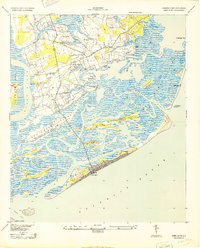
1943 Map of James Island
USGS Topo · Published 1943About this map
Sol Legare Island and the intricate tidal marshes south of Charleston define this 1943 landscape, captured just as World War II-era defense and infrastructure were reshaping the South Carolina coast. The map illustrates a transitional period for James Island, where small settlements like Centerville and Three Trees are connected by a growing network of roads and the James Island Airport. The coastal geography is highly detailed, showing the shifting sands and inlets of the barrier islands, including the prominent Morris Island and its Morris Island Coast Guard Station.
Find a feature on this map
32 named features on this map. Tap any name to fly to it.
Don’t see what you’re looking for? This feature index may not catch every label — zoom into the map to look around manually.
Map Details
Editions of this 1943 James Island Map
2 editions found

Other maps of this area

1918 · Kiawah Island
USGS Topo · 1:21,120

1919 · Johns Island
USGS Topo · 1:21,120

1919 · The Jetties
USGS Topo · 1:21,120

1919 · Wadmelaw Island
USGS Topo · 1:62,500

1919 · Charleston
USGS Topo · 1:21,120

1919 · James Island
USGS Topo · 1:21,120

1919 · Fort Moultrie
USGS Topo · 1:21,120

1919 · Legareville
USGS Topo · 1:21,120

1920 · Ravenels
USGS Topo · 1:62,500

1943 · Fort Moultrie
USGS Topo · 1:24,000