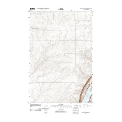
2011 Map of Jameson Lake SE
USGS Topo · Published 2011About this map
Highland Cemetery occupies a quiet position in the northeastern plateau of this landscape, marking the intersection of the region's agricultural road grid. The eastern edge of the quadrangle is defined by the sharp descent into a deep basin containing Lenore Lake and Alkali Lake. This topographic contrast between the flat upland plains and the sunken lake system highlights the distinct geological formations of Grant County. Water management is evident at the Alkali Lake Dam, which regulates the levels between these two water bodies. The rest of the sheet is dominated by a systematic network of numbered and lettered county roads, such as Whitehall Rd SE and G Rd SE, which delineate the large-scale farming and land divisions characteristic of this part of Washington.
Find a feature on this map
17 named features on this map. Tap any name to fly to it.
Don’t see what you’re looking for? This feature index may not catch every label — zoom into the map to look around manually.
Map Details
Editions of this 2011 Jameson Lake SE Map
This is the sole edition of this map. No revisions or reprints were ever made.
Other maps of this area

1953 · Ritzville
USGS Topo · 1:250,000

1956 · Ephrata
USGS Topo · 1:62,500

1956 · Soap Lake
USGS Topo · 1:24,000

1959 · Ritzville
USGS Topo · 1:250,000

1965 · Ritzville
USGS Topo · 1:250,000

1965 · Jameson Lake SW
USGS Topo · 1:24,000

1965 · Jameson Lake SE
USGS Topo · 1:24,000

1965 · St. Andrews
USGS Topo · 1:24,000

1965 · Jameson Lake West
USGS Topo · 1:24,000

1965 · Jameson Lake East
USGS Topo · 1:24,000