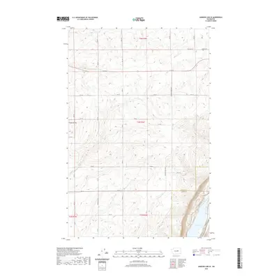
2020 Map of Jameson Lake SE
USGS Topo · Published 2020About this map
Highland Cem sits on the northern plateau of this high-desert landscape, overlooking a network of section-line roads that define the rural agricultural character of the region. The map captures the dividing line between Douglas Co and Grant Co as it descends into the Coulee floor. Along the eastern edge, the topography drops sharply toward the basin of Lenore Lake, revealing the dramatic geological transitions of the Columbia Plateau. Named routes like Highland School Rd SE and Whitehall Rd SE provide essential orientation for researchers tracing the historical placement of homesteads and local infrastructure in this expansive basalt-dominated terrain.
Find a feature on this map
27 named features on this map. Tap any name to fly to it.
Don’t see what you’re looking for? This feature index may not catch every label — zoom into the map to look around manually.
Map Details
Editions of this 2020 Jameson Lake SE Map
This is the sole edition of this map. No revisions or reprints were ever made.
Other maps of this area

1953 · Ritzville
USGS Topo · 1:250,000

1956 · Ephrata
USGS Topo · 1:62,500

1956 · Soap Lake
USGS Topo · 1:24,000

1959 · Ritzville
USGS Topo · 1:250,000

1965 · Ritzville
USGS Topo · 1:250,000

1965 · Jameson Lake SW
USGS Topo · 1:24,000

1965 · Jameson Lake SE
USGS Topo · 1:24,000

1965 · St. Andrews
USGS Topo · 1:24,000

1965 · Jameson Lake West
USGS Topo · 1:24,000

1965 · Jameson Lake East
USGS Topo · 1:24,000