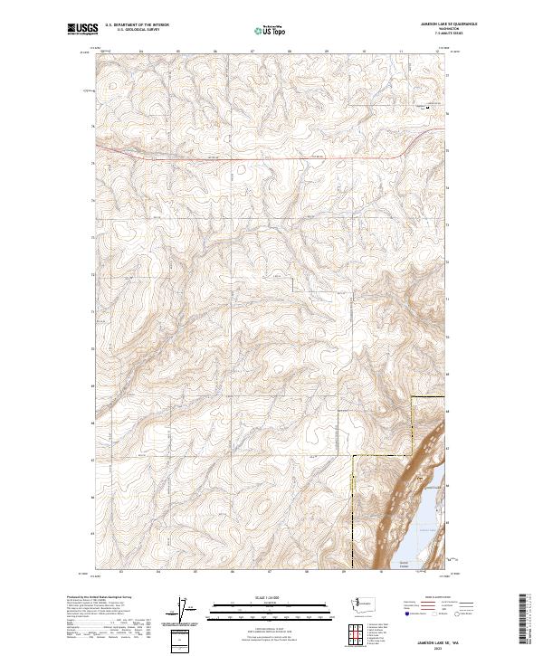
2023 Map of Jameson Lake SE
USGS Topo · Published 2023About this map
Coyote Canyon and the high plateaus of Douglas County define this landscape, where the plateau drops sharply into the dramatic geography of the Grand Coulee. Along this eastern edge, the map captures the northern tip of Lenore Lake and the protected lands of the Lenore Game Range, illustrating the sharp transition from agricultural uplands to the coulee floor. The plateau is carved by a precise grid of rural roads, including E Baseline Rd and K Rd SE, reflecting the systematic land division of the region. Near the northern boundary, the Highland Cem sits as a lonely landmark among the section lines, while the border between Douglas Co and Grant Co follows the natural path of the coulee. This survey provides a clear look at how human infrastructure and property lines are dictated by the underlying glacial-cut terrain.
Find a feature on this map
20 named features on this map. Tap any name to fly to it.
Don’t see what you’re looking for? This feature index may not catch every label — zoom into the map to look around manually.
Map Details
Editions of this 2023 Jameson Lake SE Map
This is the sole edition of this map. No revisions or reprints were ever made.
Other maps of this area

1953 · Ritzville
USGS Topo · 1:250,000

1956 · Ephrata
USGS Topo · 1:62,500

1956 · Soap Lake
USGS Topo · 1:24,000

1959 · Ritzville
USGS Topo · 1:250,000

1965 · Ritzville
USGS Topo · 1:250,000

1965 · Jameson Lake SW
USGS Topo · 1:24,000

1965 · Jameson Lake SE
USGS Topo · 1:24,000

1965 · St. Andrews
USGS Topo · 1:24,000

1965 · Jameson Lake West
USGS Topo · 1:24,000

1965 · Jameson Lake East
USGS Topo · 1:24,000