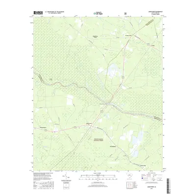
2017 Map of Jamestown
USGS Topo · Published 2017About this map
The Santee River carves a winding path through the heart of this Lowcountry landscape, separating the bottomlands of Gregler Swamp and Wittee Island from the upland settlements. To the south, the Francis Marion National Forest encompasses a significant portion of the terrain, where small communities like Washington and Palmerville are connected by historical routes such as French Santee Rd and Gilliard Lake Rd. The town of Jamestown sits as a central hub near the Leneuds-Ferry Bridge, a crossing point that has long served as a vital link across the river.
Find a feature on this map
51 named features on this map. Tap any name to fly to it.
Don’t see what you’re looking for? This feature index may not catch every label — zoom into the map to look around manually.
Map Details
Editions of this 2017 Jamestown Map
This is the sole edition of this map. No revisions or reprints were ever made.
Other maps of this area

1919 · Cordesville
USGS Topo · 1:48,000

1942 · Cedar Creek
USGS Topo · 1:24,000

1942 · Honey Hill
USGS Topo · 1:24,000

1943 · Shulerville
USGS Topo · 1:24,000

1943 · Trio
USGS Topo · 1:24,000

1943 · Andrews
USGS Topo · 1:24,000

1943 · Jamestown
USGS Topo · 1:24,000

1943 · Bonneau
USGS Topo · 1:62,500

1948 · Bethera
USGS Topo · 1:24,000

1949 · Georgetown
USGS Topo · 1:250,000