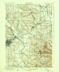
1905 Map of Jamestown
USGS Topo · Published 1935About this map
Jamestown stands as the industrial and transit hub of this Western New York landscape at the turn of the century, situated where the Dunkirk Allegheny and Pittsburg R. R. meets the Erie R. R.. The map reveals a sophisticated network of waterways and early infrastructure, including the State Drainage Ditch Line and the Buffalo and Jamestown Line. Settlements like Falconer, Frewsburg, and Kennedy are anchored by the winding course of Conewango Creek and its many tributaries, such as Cassadaga Creek and Stillwater Creek.
Find a feature on this map
56 named features on this map. Tap any name to fly to it.
Don’t see what you’re looking for? This feature index may not catch every label — zoom into the map to look around manually.
Map Details
Editions of this 1905 Jamestown Map
5 editions found
Other maps of this area

1900 · Dunkirk
USGS Topo · 1:62,500

1900 · Cherry Creek
USGS Topo · 1:62,500

1904 · Chautaqua
USGS Topo · 1:62,500

1905 · Jamestown
USGS Topo · 1:62,500

1906 · Warren
USGS Topo · 1:62,500

1907 · Warren
USGS Topo · 1:62,500

1908 · Warren
USGS Topo · 1:62,500

1922 · Randolph
USGS Topo · 1:62,500

1923 · Randolph
USGS Topo · 1:62,500

1923 · Cattaraugus
USGS Topo · 1:62,500