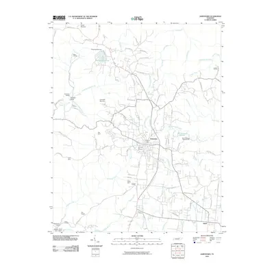
2010 Map of Jamestown
USGS Topo · Published 2010About this map
Jamestown serves as the central hub of this Fentress County landscape, characterized by its position atop the Cumberland Plateau and the numerous drainages that carve into its flanks. To the south lies the settlement of Allardt, while the surrounding terrain is marked by distinctive features like The Temple and several deep coves, including Buffalo Cove and Rockcastle Cove. The area's resource history is evidenced by the David Crockett Mine south of the city center.
Find a feature on this map
92 named features on this map. Tap any name to fly to it.
Don’t see what you’re looking for? This feature index may not catch every label — zoom into the map to look around manually.
Map Details
Editions of this 2010 Jamestown Map
This is the sole edition of this map. No revisions or reprints were ever made.
Other maps of this area

1895 · Wartburg
USGS Topo · 1:125,000

1896 · Wartburg
USGS Topo · 1:125,000

1897 · Standingstone
USGS Topo · 1:125,000

1898 · Standingstone
USGS Topo · 1:125,000
1929 · Byrdstown
USGS Topo · 1:62,500
1934 · Pall Mall
USGS Topo · 1:62,500
1954 · Stockton
USGS Topo · 1:24,000
1954 · Burrville
USGS Topo · 1:24,000
1954 · Jamestown
USGS Topo · 1:24,000
1954 · Grimsley
USGS Topo · 1:24,000