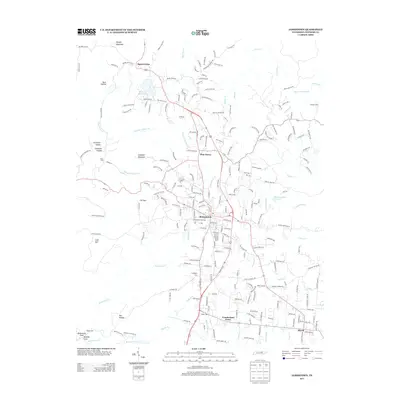
2013 Map of Jamestown
USGS Topo · Published 2013About this map
Jamestown serves as the central hub of this Fentress County landscape, where the plateau terrain is defined by deep hollows and prominent spurs. The town layout is surrounded by a network of rural settlements including Pine Haven, Squirrel Flat, and Allardt. Water features are abundant, from the Old Jamestown Reservoir and Wispering Winds Lake to the winding course of Rockcastle Cr and Yellow Cr. The map reveals a dense concentration of local family history through numerous burial grounds like Jamestown City Cem, Livingston Cem, and Taylor Cem. The topography is marked by significant landforms such as Wright Mountain, Campbell Mountain, and The Temple, while the drainage patterns of Buffalo Br and White Oak Cr carve through the region. This 2013 survey provides a detailed look at the modern road network, including numerous named lanes like Charlie Doss Rd and Joe Morris Rd, that connect these established upland communities.
Find a feature on this map
218 named features on this map. Tap any name to fly to it.
Don’t see what you’re looking for? This feature index may not catch every label — zoom into the map to look around manually.
Map Details
Editions of this 2013 Jamestown Map
This is the sole edition of this map. No revisions or reprints were ever made.
Other maps of this area

1895 · Wartburg
USGS Topo · 1:125,000

1896 · Wartburg
USGS Topo · 1:125,000

1897 · Standingstone
USGS Topo · 1:125,000

1898 · Standingstone
USGS Topo · 1:125,000

1929 · Byrdstown
USGS Topo · 1:62,500

1934 · Pall Mall
USGS Topo · 1:62,500

1954 · Stockton
USGS Topo · 1:24,000

1954 · Burrville
USGS Topo · 1:24,000

1954 · Jamestown
USGS Topo · 1:24,000

1954 · Grimsley
USGS Topo · 1:24,000