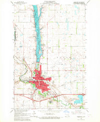
1966 Map of Jamestown
USGS Topo · Published 1967About this map
Jamestown dominates this mid-1960s landscape, positioned at the critical junction of the James River and several rail corridors. The town's layout is defined by the tracks of the Northern Pacific and the Midland Continental, which supported the regional economy of Stutsman County. Institutional life is remarkably well-documented, featuring Jamestown College, St Johns Academy, and the expansive State Hospital grounds.
Find a feature on this map
56 named features on this map. Tap any name to fly to it.
Don’t see what you’re looking for? This feature index may not catch every label — zoom into the map to look around manually.
Map Details
Editions of this 1966 Jamestown Map
2 editions found
Other maps of this area

1896 · Jamestown
USGS Topo · 1:125,000

1900 · Pingree
USGS Topo · 1:125,000

1900 · Pingree
USGS Topo · 1:62,500

1950 · Buchanan
USGS Topo · 1:24,000

1950 · Fried
USGS Topo · 1:24,000

1951 · Jamestown
USGS Topo · 1:24,000

1951 · Fried
USGS Topo · 1:24,000

1951 · Spiritwood Lake
USGS Topo · 1:24,000

1951 · Eldridge SE
USGS Topo · 1:24,000

1952 · Buchanan
USGS Topo · 1:24,000