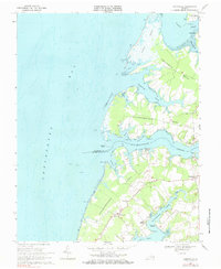
1968 Map of Jamesville
USGS Topo · Published 1982About this map
The maritime landscape of Virginia's Eastern Shore is defined here by the intricate branching of Occohannock Creek and Nassawadox Creek into the Chesapeake Bay. During the late 1960s, these tidal waters remained the lifeblood of small communities like Jamesville and Wardtown, where the geography of "necks"—narrow peninsulas of land—dictated settlement patterns. Notable landforms such as Scarborough Neck and Craddock Neck are interlaced with numerous coves and guts, illustrating a transition between agrarian interior lands and the salt marshes of Hyslop Marsh. The presence of several landings and wharves, including Concord Wharf, James Wharf, and Davis Wharf, points to a long history of water-based commerce and fishing. Cultural anchors for the local population are visible in the placement of St Marys Ch and Bethel Ch, alongside various small family or community Cem sites scattered across the low-lying terrain.
Find a feature on this map
38 named features on this map. Tap any name to fly to it.
Don’t see what you’re looking for? This feature index may not catch every label — zoom into the map to look around manually.
Map Details
Editions of this 1968 Jamesville Map
4 editions found
Other maps of this area

1942 · Nandua Creek
USGS Topo · 1:24,000

1942 · Nassawadox
USGS Topo · 1:24,000

1943 · Nassawadox
USGS Topo · 1:31,680

1943 · Jamesville
USGS Topo · 1:31,680

1943 · Pungoteague
USGS Topo · 1:31,680

1943 · Franktown
USGS Topo · 1:31,680

1943 · Exmore
USGS Topo · 1:24,000

1943 · Richmond
USGS Topo · 1:250,000

1944 · Exmore
USGS Topo · 1:31,680

1946 · Eastville
USGS Topo · 1:250,000