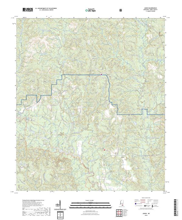
2024 Map of Janice
USGS Topo · Published 2024About this map
De Soto National Forest dominates this section of Perry County, where the landscape is defined by the winding course of the Black Creek Wild and Scenic River. The settlement of Janice serves as a local focal point near the junction of several rural routes including Janice School Rd and Snider Rd. The northern portion of the map includes a segment of the Camp Shelby military installation, indicating the region's importance for defense training amidst the timberlands. For those tracing local families, Mixon Cem provides a specific point of interest. The area's complex hydrology is evident in the numerous drainages feeding into Black Creek, such as West Prong Mill Creek and East Prong Mill Creek, while the Black Creek Wilderness in the southeast preserves the most primitive character of the bottomland hardwood environment.
Find a feature on this map
54 named features on this map. Tap any name to fly to it.
Don’t see what you’re looking for? This feature index may not catch every label — zoom into the map to look around manually.
Map Details
Editions of this 2024 Janice Map
This is the sole edition of this map. No revisions or reprints were ever made.
Other maps of this area

1947 · Beaumont
USGS Topo · 1:62,500

1947 · Wiggins
USGS Topo · 1:62,500

1947 · New Augusta
USGS Topo · 1:62,500

1947 · Benndale
USGS Topo · 1:62,500

1949 · Wiggins
USGS Topo · 1:62,500

1949 · Beaumont
USGS Topo · 1:62,500

1949 · New Augusta
USGS Topo · 1:62,500

1949 · Benndale
USGS Topo · 1:62,500

1953 · Hattiesburg
USGS Topo · 1:250,000

1953 · Mobile
USGS Topo · 1:250,000