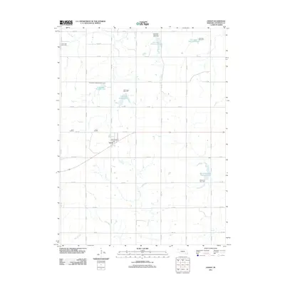
2011 Map of Jansen
USGS Topo · Published 2011About this map
The village of Jansen serves as the primary hub in this corner of Jefferson County, where the local economy is tied to the plains and its drainage systems. The Jansen Post Office and the rail-aligned orientation of the town reflect its role as a regional gathering point. Water management defines the landscape, with numerous installations such as the Cub Creek Reservoir 13-C and Big Indian Creek Reservoir 10-A designed to regulate the flow of Cub Creek and Big Indian Creek across the agricultural grid.
Find a feature on this map
33 named features on this map. Tap any name to fly to it.
Don’t see what you’re looking for? This feature index may not catch every label — zoom into the map to look around manually.
Map Details
Editions of this 2011 Jansen Map
This is the sole edition of this map. No revisions or reprints were ever made.
Other maps of this area

1955 · Lincoln
USGS Topo · 1:250,000

1957 · Lincoln
USGS Topo · 1:250,000

1957 · Plymouth
USGS Topo · 1:24,000

1958 · Lincoln
USGS Topo · 1:250,000

1960 · Fairbury SW
USGS Topo · 1:24,000

1960 · Western SW
USGS Topo · 1:24,000

1960 · Fairbury
USGS Topo · 1:24,000

1961 · Western SE
USGS Topo · 1:24,000
1970 · Harbine
USGS Topo · 1:24,000
1970 · Endicott
USGS Topo · 1:24,000