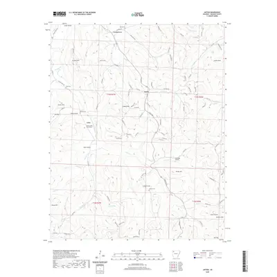
2020 Map of Japton
USGS Topo · Published 2020About this map
Japton and the surrounding rural reaches of Madison County appear in this 1980s survey as a region defined by its complex topography and dispersed settlements. Local history is etched into the land through sites like Duncan Cem, Parker Cem, and Grose Cem, which serve as vital markers for genealogical research. The terrain is characterized by numerous peaks and hollows, including Faulkner Mtn, Potato Knob, and Ridley Hollow. Watercourses such as Drakes Cr and Lollars Cr wind through the valleys, illustrating the natural drainage patterns of the area. The presence of the Lollars Creek Farm Airport near Asher suggests the importance of light aviation for this rural community. Researchers can also trace the boundaries of Township 15 North, Range 27 West (t15n r27w), providing a clear framework for land ownership and historical property records in this portion of the Arkansas Ozarks.
Find a feature on this map
98 named features on this map. Tap any name to fly to it.
Don’t see what you’re looking for? This feature index may not catch every label — zoom into the map to look around manually.
Map Details
Editions of this 2020 Japton Map
This is the sole edition of this map. No revisions or reprints were ever made.
Other maps of this area

1900 · Eureka Springs
USGS Topo · 1:125,000

1901 · Eureka Springs
USGS Topo · 1:125,000

1943 · St. Paul
USGS Topo · 1:62,500

1945 · Harrison
USGS Topo · 1:250,000

1946 · St. Paul
USGS Topo · 1:62,500

1949 · Harrison
USGS Topo · 1:250,000

1954 · Harrison
USGS Topo · 1:250,000

1956 · Russellville
USGS Topo · 1:250,000
1958 · Goshen
USGS Topo · 1:24,000

1958 · Harrison
USGS Topo · 1:250,000