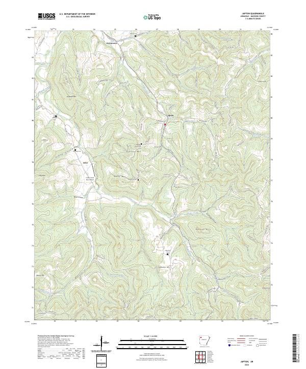
2024 Map of Japton
USGS Topo · Published 2024About this map
Georgetown and the rural crossroads of Japton and Asher anchor this Madison County landscape, where the terrain is defined by a dense network of hollows and ridges. The drainage of Drakes Creek and Lollars Creek carves through the Ozark highlands, creating a topography that influenced early settlement patterns and the placement of several small family cemeteries. Genealogy researchers can find several burial grounds such as Duncan Cem, Eubanks McChristian Cem, and Ledbetter Cem scattered near the peaks of Eubanks Mtn and Ledbetter Mtn. The presence of the Lollars Creek Farm Airport near Asher highlights the intersection of modern utility with the region's traditional land use. This survey illustrates how contemporary road networks, like Co RD 6330, follow the ancient contours of the land, connecting landmarks such as Parker Hill and Jackson Knob while preserving the names of the families who originally worked these hills.
Find a feature on this map
96 named features on this map. Tap any name to fly to it.
Don’t see what you’re looking for? This feature index may not catch every label — zoom into the map to look around manually.
Map Details
Editions of this 2024 Japton Map
This is the sole edition of this map. No revisions or reprints were ever made.
Other maps of this area

1900 · Eureka Springs
USGS Topo · 1:125,000

1901 · Eureka Springs
USGS Topo · 1:125,000

1943 · St. Paul
USGS Topo · 1:62,500

1945 · Harrison
USGS Topo · 1:250,000

1946 · St. Paul
USGS Topo · 1:62,500

1949 · Harrison
USGS Topo · 1:250,000

1954 · Harrison
USGS Topo · 1:250,000

1956 · Russellville
USGS Topo · 1:250,000
1958 · Goshen
USGS Topo · 1:24,000

1958 · Harrison
USGS Topo · 1:250,000