
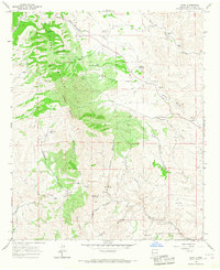
1965 Map of Jaralosa Mountain
USGS Topo · Published 1967About this map
The Sierra Cuchillo Hills dominate the western half of this mid-1960s survey, marking a distinct transition from the high ridges of Jaralosa Mountain and Juan Peak toward the eastern drainages of Alamosa Creek. This high-desert landscape in Sierra Co and Socorro Co shows a specialized ranching economy reliant on carefully managed water sources, including the Sophie Windmill, Sedillo Wells, and the notable Monticello Community Ditch that feeds toward the east. Human presence is scattered across the range at sites like the Serna Mine and residential outposts such as Rouse Place and the H V L Ranch. Notable local landmarks like Bootlegger Gap and the Blue Hills are mapped alongside a complex network of seasonal watercourses like Grapevine Canyon and Shipman Canyon, illustrating the challenging environment of the Cibola National Forest boundary lands during this era.
Find a feature on this map
47 named features on this map. Tap any name to fly to it.
Don’t see what you’re looking for? This feature index may not catch every label — zoom into the map to look around manually.
Map Details
Editions of this 1965 Jaralosa Mountain Map
This is the sole edition of this map. No revisions or reprints were ever made.
Other maps of this area

1954 · Tularosa
USGS Topo · 1:250,000

1958 · Tularosa
USGS Topo · 1:250,000

1961 · Priest Tank
USGS Topo · 1:24,000

1961 · Monticello
USGS Topo · 1:24,000

1964 · Vicks Peak
USGS Topo · 1:24,000

1964 · Montoya Butte
USGS Topo · 1:24,000

1965 · Winston
USGS Topo · 1:24,000

1965 · Iron Mountain
USGS Topo · 1:24,000
1965 · Chise
USGS Topo · 1:24,000

1979 · Truth or Consequences
USGS Topo · 1:100,000