
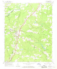
1966 Map of Jarratt
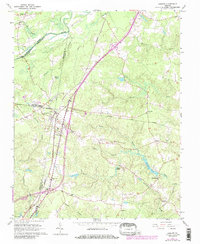
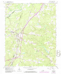
USGS Topo · Published 1984About this map
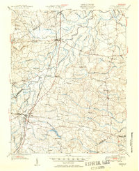
Jarratt serves as the central hub of this 1960s landscape, straddling the line between Sussex and Greensville counties. The town's significance as a rail junction is clear, where the north-south Seaboard Coast Line intersects the east-west Norfolk and Western tracks. This intersection supported a local economy of timber and agriculture, evidenced by the numerous named swamps and branches like Harris Swamp and Poplar Swamp that define the drainage of the Nottoway River basin.
Find a feature on this map
46 named features on this map. Tap any name to fly to it.
Don’t see what you’re looking for? This feature index may not catch every label — zoom into the map to look around manually.
Map Details
Editions of this 1966 Jarratt Map
4 editions found
Other maps of this area

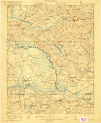
1919 · Jarratt
USGS Topo · 1:62,500

1919 · Mc Kenney
USGS Topo · 1:48,000

1919 · Emporia
USGS Topo · 1:62,500

1919 · Arringdale
USGS Topo · 1:48,000
1920 · Arringdale
USGS Topo · 1:62,500

1921 · Mc Kenney
USGS Topo · 1:62,500

1942 · Arringdale
USGS Topo · 1:62,500

1942 · Emporia
USGS Topo · 1:62,500

1943 · Mc Kenney
USGS Topo · 1:62,500
1951 · Jarratt
USGS Topo · 1:62,500