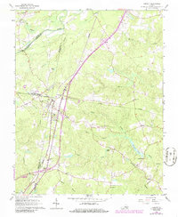
1966 Map of Jarratt
USGS Topo · Published 1986About this map
Jarratt serves as a central junction where the Seaboard Coast Line and Norfolk and Western railroads intersect, shaping the local geography of the Sussex and Greenesville county line. The landscape is defined by the intricate waterways of the Nottoway River basin, including Chetooric Swamp, Hickory Swamp, and the wide Flat Swamp to the north. These wetlands are interspersed with small communities and family landmarks such as Harrells Mill and the Smith Bridge crossing.
Find a feature on this map
43 named features on this map. Tap any name to fly to it.
Don’t see what you’re looking for? This feature index may not catch every label — zoom into the map to look around manually.
Map Details
Editions of this 1966 Jarratt Map
4 editions found
Other maps of this area

1919 · Jarratt
USGS Topo · 1:62,500

1919 · Mc Kenney
USGS Topo · 1:48,000

1919 · Emporia
USGS Topo · 1:62,500

1919 · Arringdale
USGS Topo · 1:48,000

1920 · Arringdale
USGS Topo · 1:62,500

1921 · Mc Kenney
USGS Topo · 1:62,500

1942 · Arringdale
USGS Topo · 1:62,500

1942 · Emporia
USGS Topo · 1:62,500

1943 · Mc Kenney
USGS Topo · 1:62,500

1951 · Jarratt
USGS Topo · 1:62,500