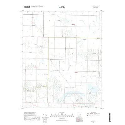
2020 Map of Jasmine
USGS Topo · Published 2020About this map
Belcher and Jasmine anchor this survey of the low-lying wetlands and bottomlands where White and Prairie counties meet. The landscape is defined by an intricate network of waterways, including the winding Bayou Des Arc and numerous named backwaters like Diamond Pond, Keathley Pond, and Taylor Pond. Higher ground is marked by prominent local rises such as Big Greenbrier Hill and Little Greenbrier Hill, which provide relief from the surrounding marshes. Genealogists will find the locations of the Belcher Cem and Griffin Cem useful for local family research. The map also documents the complex drainage patterns of the region, featuring several sloughs and brakes such as Redman Lake Slough, Hughes Slough, and Rayburn Brake. These features, alongside Lake Des Arc, illustrate a terrain where seasonal water levels dictate the movement across the rural landscape.
Find a feature on this map
76 named features on this map. Tap any name to fly to it.
Don’t see what you’re looking for? This feature index may not catch every label — zoom into the map to look around manually.
Map Details
Editions of this 2020 Jasmine Map
This is the sole edition of this map. No revisions or reprints were ever made.
Other maps of this area

1932 · Kensett
USGS Topo · 1:62,500

1935 · Kensett
USGS Topo · 1:62,500

1935 · Hazen
USGS Topo · 1:62,500

1935 · Gregory
USGS Topo · 1:62,500

1941 · Hazen
USGS Topo · 1:62,500

1941 · De Valls Bluff
USGS Topo · 1:62,500

1948 · Helena
USGS Topo · 1:250,000

1950 · Helena
USGS Topo · 1:250,000

1953 · Memphis
USGS Topo · 1:250,000

1955 · Helena
USGS Topo · 1:250,000