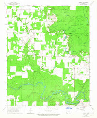
1964 Map of Jasmine
USGS Topo · Published 1965About this map
The lowlands of the White River basin define the landscape of this mid-1960s survey along the White Co Prairie Co boundary. The area is characterized by an intricate network of waterways and wetlands, including Eagle Brake, Watkins Brake, and Beaver Pond Slough. These natural features intersect with the human footprint of small rural settlements like Jasmine and Belcher.
Find a feature on this map
60 named features on this map. Tap any name to fly to it.
Don’t see what you’re looking for? This feature index may not catch every label — zoom into the map to look around manually.
Map Details
Editions of this 1964 Jasmine Map
This is the sole edition of this map. No revisions or reprints were ever made.
Other maps of this area

1932 · Kensett
USGS Topo · 1:62,500

1935 · Kensett
USGS Topo · 1:62,500

1935 · Hazen
USGS Topo · 1:62,500

1935 · Gregory
USGS Topo · 1:62,500

1941 · Hazen
USGS Topo · 1:62,500

1941 · De Valls Bluff
USGS Topo · 1:62,500

1948 · Helena
USGS Topo · 1:250,000

1950 · Helena
USGS Topo · 1:250,000

1953 · Memphis
USGS Topo · 1:250,000

1955 · Helena
USGS Topo · 1:250,000