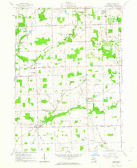
1962 Map of Jasper
USGS Topo · Published 1963About this map
Jasper and Weston anchor this southern Lenawee County landscape, appearing here as they were in the early 1960s. The region is defined by a dense network of water management, including the Mull and Fairfield Drain and Savage Drain, supporting the productive agricultural townships of Fairfield and Madison. A notable transportation hub is evident at Sand Creek, where the Wabash RR intersects with the local road system near the Sand Creek Agriculture Sch.
Find a feature on this map
69 named features on this map. Tap any name to fly to it.
Don’t see what you’re looking for? This feature index may not catch every label — zoom into the map to look around manually.
Map Details
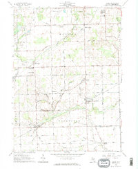
Editions of this 1962 Jasper Map
2 editions found
Other maps of this area

1911 · Wauseon
USGS Topo · 1:62,500

1911 · Swanton
USGS Topo · 1:62,500

1913 · Wauseon
USGS Topo · 1:62,500

1914 · Swanton
USGS Topo · 1:62,500

1939 · Blissfield
USGS Topo · 1:62,500

1941 · Blissfield
USGS Topo · 1:62,500

1943 · Wauseon
USGS Topo · 1:62,500

1953 · Fort Wayne
USGS Topo · 1:250,000

1956 · Fort Wayne
USGS Topo · 1:250,000

1956 · Toledo
USGS Topo · 1:250,000