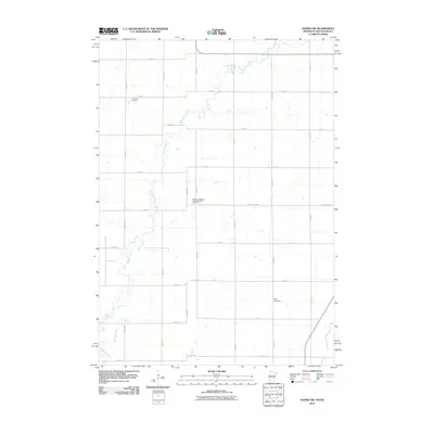
2010 Map of Jasper NW
USGS Topo · Published 2010About this map
Pipestone Creek meanders through this agricultural landscape on the border of Minnesota and South Dakota, carving a natural path across a grid of section-line roads. The landscape is primarily defined by its rural layout, where large tracts of land are punctuated by small family and community burial grounds that speak to the area's pioneer heritage. Among these are Lone Rock Cemetery in the northern reaches and Eden Cemetery further south, providing clear anchor points for genealogical research. The presence of the Salem Evangelical United Brethren Cemetery along County Hwy-52 reflects the religious and social centers that once served the dispersed farming population. This survey illustrates the persistent geometry of Midwestern farm life, where the original township grids remain the primary framework for local travel and land organization.
Find a feature on this map
26 named features on this map. Tap any name to fly to it.
Don’t see what you’re looking for? This feature index may not catch every label — zoom into the map to look around manually.
Map Details
Editions of this 2010 Jasper NW Map
This is the sole edition of this map. No revisions or reprints were ever made.
Other maps of this area

1953 · Watertown
USGS Topo · 1:250,000

1955 · Sioux Falls
USGS Topo · 1:250,000

1958 · Sioux Falls
USGS Topo · 1:250,000

1958 · Watertown
USGS Topo · 1:250,000

1967 · Pipestone North
USGS Topo · 1:24,000

1967 · Elkton SW
USGS Topo · 1:24,000

1967 · Jasper SE
USGS Topo · 1:24,000

1967 · Pipestone South
USGS Topo · 1:24,000

1967 · Jasper
USGS Topo · 1:24,000

1967 · Jasper NW
USGS Topo · 1:24,000