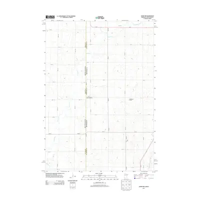
2013 Map of Jasper NW
USGS Topo · Published 2013About this map
The high plateau of the Coteau des Prairies defines the geography of this borderland between South Dakota and Minnesota. This 2013 survey captures a landscape dominated by a precise grid of rural roads and agricultural development, punctuated by the winding courses of Pipestone Cr and Split Rock Cr. For family historians and genealogists, the map identifies specific rural landmarks such as the Salem Evangelical United Brethren Cem and Eden Cem, which serve as quiet anchors for the surrounding farming communities. The state line divides Moody Co in South Dakota from Pipestone Co in Minnesota, following a straight north-south trajectory that cuts across the natural drainage patterns of the South Br Pipestone Cr. This map illustrates the intersection of modern highway infrastructure like MN-30 and MN-23 with established family operations such as Ulik Farms.
Find a feature on this map
34 named features on this map. Tap any name to fly to it.
Don’t see what you’re looking for? This feature index may not catch every label — zoom into the map to look around manually.
Map Details
Editions of this 2013 Jasper NW Map
This is the sole edition of this map. No revisions or reprints were ever made.
Other maps of this area

1953 · Watertown
USGS Topo · 1:250,000

1955 · Sioux Falls
USGS Topo · 1:250,000

1958 · Sioux Falls
USGS Topo · 1:250,000

1958 · Watertown
USGS Topo · 1:250,000

1967 · Pipestone North
USGS Topo · 1:24,000

1967 · Elkton SW
USGS Topo · 1:24,000

1967 · Jasper SE
USGS Topo · 1:24,000

1967 · Pipestone South
USGS Topo · 1:24,000

1967 · Jasper
USGS Topo · 1:24,000

1967 · Jasper NW
USGS Topo · 1:24,000