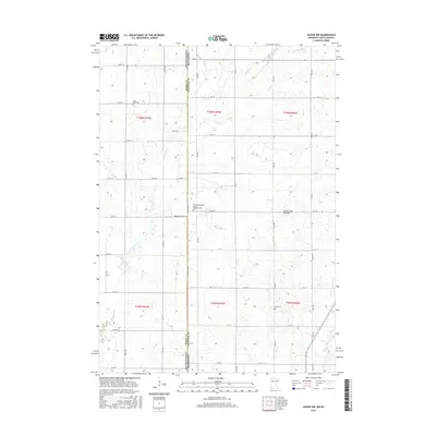
2016 Map of Jasper NW
USGS Topo · Published 2016About this map
The high plateau of the Coteau des Prairies defines the landscape along the border of Moody County, South Dakota, and Pipestone County, Minnesota. This 2016 survey documents a rural environment organized by a rigid section grid, where State Line Rd serves as the literal divide between the two states. The hydrology is dominated by the winding paths of Pipestone Cr and its tributary, the S Br Pipestone Cr, which cut through the agricultural fields. For those tracing family histories, the map preserves the locations of vital community landmarks, including the Lone Rock Cem in the northwest, the centrally located Salem Evangelical United Brethren Cem, and Eden Cem to the east. These sites, along with the network of secondary roads like Co HWY H and Co RD 53, reflect the enduring settlement patterns of this prairie region.
Find a feature on this map
46 named features on this map. Tap any name to fly to it.
Don’t see what you’re looking for? This feature index may not catch every label — zoom into the map to look around manually.
Map Details
Editions of this 2016 Jasper NW Map
This is the sole edition of this map. No revisions or reprints were ever made.
Other maps of this area

1953 · Watertown
USGS Topo · 1:250,000

1955 · Sioux Falls
USGS Topo · 1:250,000

1958 · Sioux Falls
USGS Topo · 1:250,000

1958 · Watertown
USGS Topo · 1:250,000

1967 · Pipestone North
USGS Topo · 1:24,000

1967 · Elkton SW
USGS Topo · 1:24,000

1967 · Jasper SE
USGS Topo · 1:24,000

1967 · Pipestone South
USGS Topo · 1:24,000

1967 · Jasper
USGS Topo · 1:24,000

1967 · Jasper NW
USGS Topo · 1:24,000