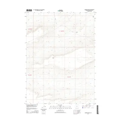
2015 Map of Jawbone Ranch
USGS Topo · Published 2015About this map
Jawbone Ranch sits within a high-elevation landscape in Sweetwater County, defined by the stark relief of the Wyoming interior. This 2015 survey illustrates a region shaped by natural drainage patterns and topographical landmarks like Windy Hill, which rises above the surrounding plateau. The map details the intricate contouring of Buck Draw, showing how water and wind have carved the terrain over millennia. As a modern digital-era topographic record, it precisely captures the sparse human footprint in this portion of the Red Desert, focusing on the isolated ranching infrastructure and the established grid of the Public Land Survey System, including sections within t22n r91w and t21n r91w.
Find a feature on this map
7 named features on this map. Tap any name to fly to it.
Don’t see what you’re looking for? This feature index may not catch every label — zoom into the map to look around manually.
Map Details
Editions of this 2015 Jawbone Ranch Map
This is the sole edition of this map. No revisions or reprints were ever made.
Other maps of this area

1954 · Rawlins
USGS Topo · 1:250,000

1958 · Rawlins
USGS Topo · 1:250,000

1960 · Hansen Lake NE
USGS Topo · 1:24,000

1960 · Larsen Knoll
USGS Topo · 1:24,000

1960 · Buck Draw
USGS Topo · 1:24,000

1962 · Rawlins
USGS Topo · 1:250,000

1966 · Jawbone Ranch
USGS Topo · 1:24,000

1966 · Creston Junction
USGS Topo · 1:24,000

1966 · Riner
USGS Topo · 1:24,000

1966 · Creston
USGS Topo · 1:24,000