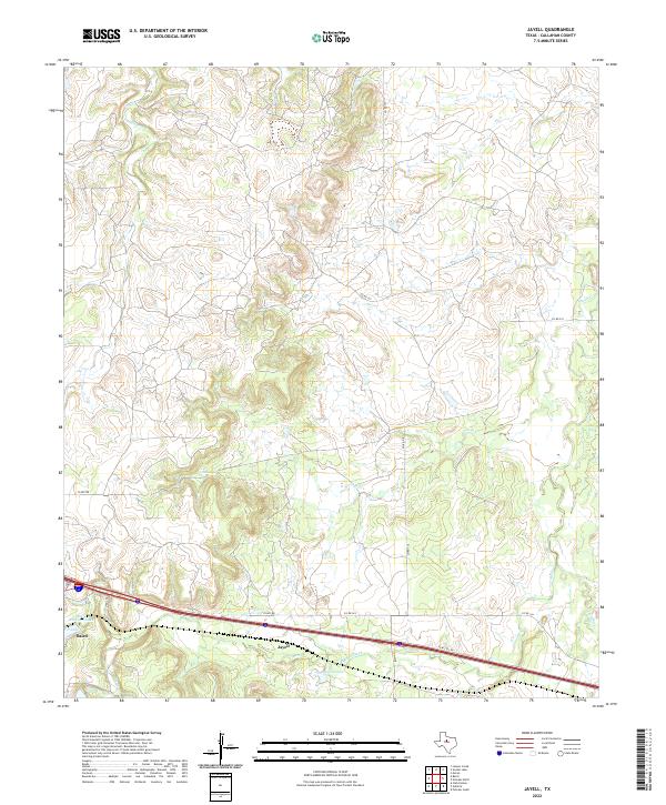
2022 Map of Jayell
USGS Topo · Published 2022About this map
Jayell and the eastern outskirts of Baird anchor this Callahan County landscape, where the modern corridor of Interstate 20 intersects a network of county roads. The terrain is defined by the drainage systems of Hubbard Cr and Sheep Cr, which carve through the undulating topography typical of this part of Texas. Evidence of historical infrastructure and water management is visible in several named reservoirs, most notably Baird Railroad Lake, a site reflecting the region's historical reliance on rail-transport water supplies. To the south, Mexia Creek and Smith Lake provide additional landmarks for local researchers. The map details a transition from the semi-urban edges of Baird into a rural expanse crisscrossed by routes like FM 2228 and Finley Rd, documenting the contemporary land use and water resources of the area.
Find a feature on this map
19 named features on this map. Tap any name to fly to it.
Don’t see what you’re looking for? This feature index may not catch every label — zoom into the map to look around manually.
Map Details
Editions of this 2022 Jayell Map
This is the sole edition of this map. No revisions or reprints were ever made.
Other maps of this area

1892 · Albany
USGS Topo · 1:125,000

1893 · Albany
USGS Topo · 1:125,000

1931 · Baird
USGS Topo · 1:125,000

1932 · Baird
USGS Topo · 1:125,000

1954 · Abilene
USGS Topo · 1:250,000

1958 · Abilene
USGS Topo · 1:250,000
1965 · Snyder Lake
USGS Topo · 1:24,000
1965 · Moran
USGS Topo · 1:24,000
1965 · Leeper Creek
USGS Topo · 1:24,000

1966 · Putnam South
USGS Topo · 1:24,000