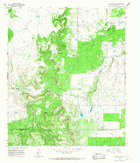
1965 Map of Snyder Lake
USGS Topo · Published 1967About this map
Hubbard Creek and its various tributaries, including the Salt Prong Hubbard Creek and Jenkins Creek, define this mid-1960s landscape along the border of Shackelford and Callahan counties. The terrain is notably dominated by petroleum extraction, with a widespread Oil Field and numerous Oil Wells scattered across the upland areas. This industrial presence is contrasted by the private water storage at Snyder Lake and Diller Lake, which likely served as crucial resources for both the local cattle ranching operations and the oil industry of the time.
Find a feature on this map
12 named features on this map. Tap any name to fly to it.
Don’t see what you’re looking for? This feature index may not catch every label — zoom into the map to look around manually.
Map Details
Editions of this 1965 Snyder Lake Map
2 editions found
Other maps of this area

1892 · Albany
USGS Topo · 1:125,000

1893 · Albany
USGS Topo · 1:125,000

1931 · Baird
USGS Topo · 1:125,000

1932 · Baird
USGS Topo · 1:125,000

1954 · Abilene
USGS Topo · 1:250,000

1958 · Abilene
USGS Topo · 1:250,000

1965 · Acampo
USGS Topo · 1:24,000

1965 · Albany
USGS Topo · 1:24,000

1965 · McCatherine Mountain
USGS Topo · 1:24,000
1965 · Moran
USGS Topo · 1:24,000