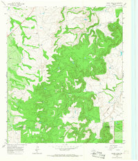
1965 Map of Leeper Creek
USGS Topo · Published 1968About this map
Leeper Creek and its numerous tributaries carve a complex drainage system across the divide of Shackelford and Callahan counties in West Texas. This mid-1960s landscape is defined by its industrial activity, notably the scattered Oil Wells and an individual Oil Well found throughout the rugged breaks. The map captures a moment of active resource extraction, where heavy machinery and drilling operations shared the land with traditional ranching interests, indicated by the presence of a Quarry and a network of high-pressure pipelines cutting across the county line. Flowing north and east, the Salt Prong Hubbard Creek and Long Creek dictate the local topography, while smaller features like Deadman Draw and Spring Creek suggest the seasonal hydrology of this cattle-and-oil country.
Find a feature on this map
11 named features on this map. Tap any name to fly to it.
Don’t see what you’re looking for? This feature index may not catch every label — zoom into the map to look around manually.
Map Details
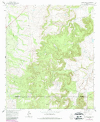
Editions of this 1965 Leeper Creek Map
2 editions found
Other maps of this area

1890 · Abilene
USGS Topo · 1:125,000

1891 · Anson
USGS Topo · 1:125,000

1892 · Abilene
USGS Topo · 1:125,000

1892 · Albany
USGS Topo · 1:125,000

1893 · Albany
USGS Topo · 1:125,000

1893 · Anson
USGS Topo · 1:125,000

1931 · Baird
USGS Topo · 1:125,000

1932 · Baird
USGS Topo · 1:125,000

1954 · Abilene
USGS Topo · 1:250,000

1957 · Kirby Lake
USGS Topo · 1:62,500