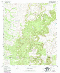
1965 Map of Leeper Creek
USGS Topo · Published 1987About this map
Leeper Creek and its numerous tributaries dominate this mid-century landscape along the border of Shackelford Co and Callahan Co. The terrain is defined by a dense network of intermittent waterways, including the Salt Prong Hubbard Creek and the meandering Deadman Draw. This period of the mid-1960s highlights the region's industrial footprint, specifically the proliferation of energy extraction efforts. Scattered throughout the hills and valleys are numerous Oil Wells and a Quarry, linked by a primary Pipeline that cuts across the southern portion of the quadrangle. The map also captures several family-named or locally descriptive landmarks such as Long Creek, Spring Creek, and Jenkins Creek, providing a detailed look at the drainage patterns and land use in this part of North Central Texas before late-century developments.
Find a feature on this map
12 named features on this map. Tap any name to fly to it.
Don’t see what you’re looking for? This feature index may not catch every label — zoom into the map to look around manually.
Map Details
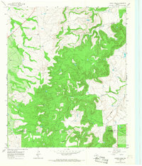
Editions of this 1965 Leeper Creek Map
2 editions found
Other maps of this area

1890 · Abilene
USGS Topo · 1:125,000

1891 · Anson
USGS Topo · 1:125,000

1892 · Abilene
USGS Topo · 1:125,000

1892 · Albany
USGS Topo · 1:125,000

1893 · Albany
USGS Topo · 1:125,000

1893 · Anson
USGS Topo · 1:125,000

1931 · Baird
USGS Topo · 1:125,000

1932 · Baird
USGS Topo · 1:125,000

1954 · Abilene
USGS Topo · 1:250,000

1957 · Kirby Lake
USGS Topo · 1:62,500