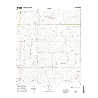
2015 Map of Jayess
USGS Topo · Published 2015About this map
Jayess and Enon anchor this rural landscape in south-central Mississippi, situated at the meeting point of Lawrence, Lincoln, and Walthall counties. The terrain is defined by a dendritic network of creek valleys, including Carters Cr and Leatherwood Cr, which have historically shaped the placement of local roads and farmsteads. A notable concentration of community landmarks appears in the southwest, particularly around the settlement of Enon, where the Enon Cem and New Bethel Cem are located.
Find a feature on this map
107 named features on this map. Tap any name to fly to it.
Don’t see what you’re looking for? This feature index may not catch every label — zoom into the map to look around manually.
Map Details
Editions of this 2015 Jayess Map
This is the sole edition of this map. No revisions or reprints were ever made.
Other maps of this area

1953 · Natchez
USGS Topo · 1:250,000

1956 · Natchez
USGS Topo · 1:250,000

1959 · Natchez
USGS Topo · 1:250,000

1970 · Kokomo
USGS Topo · 1:24,000

1970 · Mesa
USGS Topo · 1:24,000

1970 · Topeka
USGS Topo · 1:24,000

1970 · Darbun
USGS Topo · 1:24,000

1970 · Jayess
USGS Topo · 1:24,000
1970 · Tilton
USGS Topo · 1:24,000

1972 · Ruth
USGS Topo · 1:24,000