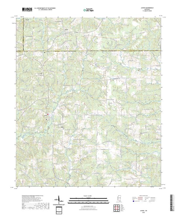
2024 Map of Jayess
USGS Topo · Published 2024About this map
Jayess sits at a crossroads in the hills of southern Mississippi, where the boundaries of Lincoln, Lawrence, and Walthall Counties converge. This 2024 landscape is defined by the winding paths of Carters Creek and Magers Creek, which cut through a network of rural roads bearing the names of long-established local families. The settlement of Enon serves as a local anchor in the southwest, while scattered community centers like Verna and Hope Hill mark the northern reaches. For genealogists and local historians, the map is a vital record of legacy, pinpointing established sites such as Enon Cem, Greer Cem, and New Bethel Cem. The road names themselves—including Jessie Wallace Rd, Phillips McCain Rd, and Dewitt Alexander Rd—suggest the deep ancestral roots tied to specific parcels of land across these rolling timberlands and pastures.
Find a feature on this map
110 named features on this map. Tap any name to fly to it.
Don’t see what you’re looking for? This feature index may not catch every label — zoom into the map to look around manually.
Map Details
Editions of this 2024 Jayess Map
This is the sole edition of this map. No revisions or reprints were ever made.
Other maps of this area

1953 · Natchez
USGS Topo · 1:250,000

1956 · Natchez
USGS Topo · 1:250,000

1959 · Natchez
USGS Topo · 1:250,000

1970 · Kokomo
USGS Topo · 1:24,000

1970 · Mesa
USGS Topo · 1:24,000

1970 · Topeka
USGS Topo · 1:24,000

1970 · Darbun
USGS Topo · 1:24,000

1970 · Jayess
USGS Topo · 1:24,000
1970 · Tilton
USGS Topo · 1:24,000

1972 · Ruth
USGS Topo · 1:24,000