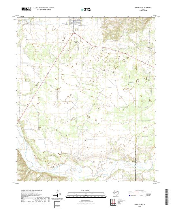
2022 Map of Jayton South
USGS Topo · Published 2022About this map
The town of Jayton serves as the focal point for this survey of west Texas ranchland, where the Kent County Courthouse anchors the local street grid. The landscape to the south is defined by the winding course of the Salt Fork Brazos River, a significant waterway fed by intermittent streams such as A B C Cr and Little Duck Cr. This area illustrates the classic rural Texas layout of the early 21st century, where large tracts of open land are segmented by established county roads and farm-to-market routes like FM 1083. Local aviation and regional landmarks are represented by Kent County Airport and Norris Field, while the eastern boundary tracks the Kent Co Stonewall Co line through the breaks of Carter Draw and Salt Cr.
Find a feature on this map
29 named features on this map. Tap any name to fly to it.
Don’t see what you’re looking for? This feature index may not catch every label — zoom into the map to look around manually.
Map Details
Editions of this 2022 Jayton South Map
This is the sole edition of this map. No revisions or reprints were ever made.
Other maps of this area

1954 · Lubbock
USGS Topo · 1:250,000

1958 · Seven Diamond L Canyon
USGS Topo · 1:24,000

1958 · Jayton
USGS Topo · 1:24,000

1959 · Girard
USGS Topo · 1:24,000

1968 · Double Mountains
USGS Topo · 1:24,000

1968 · Peacock
USGS Topo · 1:24,000
1969 · A B C Creek
USGS Topo · 1:24,000

1969 · Clairemont East
USGS Topo · 1:24,000

1969 · Jayton South
USGS Topo · 1:24,000
1969 · Gant Hills
USGS Topo · 1:24,000