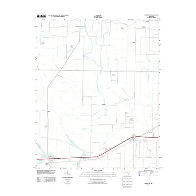
2011 Map of Jeanette
USGS Topo · Published 2011About this map
Blackfish Bayou winds through the heart of this Crittenden County landscape, serving as a central drainage feature for the surrounding agricultural plains. The area is defined by a series of small, interconnected settlements including Jennette, Jeanette, and Shearerville, which are positioned along the primary transit corridors. A significant network of bayous and lakes, such as Wildcat Bayou, Buck Lake, and Shell Lake, illustrates the low-lying, water-dependent nature of the Arkansas Delta. Local history is deeply embedded in the land through numerous small burial grounds, including Mount Beulah Cemetery and Pilgrim Rest Cemetery, which often represent the only remaining landmarks of earlier community centers. The presence of Bernard Manor Airport and the intersection of modern interstate and local routes, like County Rd-37 and Jennette Rd, highlight the shift toward more modern transportation and regional connectivity.
Find a feature on this map
64 named features on this map. Tap any name to fly to it.
Don’t see what you’re looking for? This feature index may not catch every label — zoom into the map to look around manually.
Map Details
Editions of this 2011 Jeanette Map
This is the sole edition of this map. No revisions or reprints were ever made.
Other maps of this area

1939 · Edmondson
USGS Topo · 1:62,500

1940 · Deckerville
USGS Topo · 1:62,500

1940 · Princedale
USGS Topo · 1:62,500

1940 · Whitmore
USGS Topo · 1:62,500

1953 · Memphis
USGS Topo · 1:250,000

1954 · Edmondson
USGS Topo · 1:62,500

1956 · Memphis
USGS Topo · 1:250,000

1956 · Whitmore
USGS Topo · 1:62,500

1956 · Princedale
USGS Topo · 1:62,500

1957 · Deckerville
USGS Topo · 1:62,500