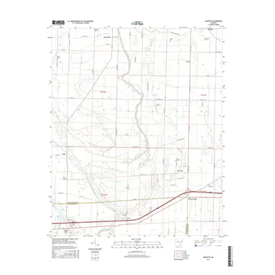
2017 Map of Jeanette
USGS Topo · Published 2017About this map
Blackfish Bayou winds through the heart of this East Arkansas landscape, defining a network of wetlands and oxbow lakes including Holden Lake, Buck Lake, and Shell Lake. Near the border of Crittenden and St. Francis counties, the small settlements of Jennette and Shearerville serve as anchors for a rural community connected by a dense grid of local roads like Bings Store Rd and Dixie Rd. The map is particularly rich for genealogical research, documenting numerous community burial sites such as New Shady Grove Cem, Pilgrim Rest Cem, and Macedonia Cem. Aviation and agriculture intersect at Mc Neely Airport, while the presence of Wildcat Bayou and Alligator Bayou reflects the delta's complex hydrology. The southern portion of the sheet is dominated by the modern transport corridor where Interstate 40 meets the local bayou system.
Find a feature on this map
68 named features on this map. Tap any name to fly to it.
Don’t see what you’re looking for? This feature index may not catch every label — zoom into the map to look around manually.
Map Details
Editions of this 2017 Jeanette Map
This is the sole edition of this map. No revisions or reprints were ever made.
Other maps of this area

1939 · Edmondson
USGS Topo · 1:62,500

1940 · Deckerville
USGS Topo · 1:62,500

1940 · Princedale
USGS Topo · 1:62,500

1940 · Whitmore
USGS Topo · 1:62,500

1953 · Memphis
USGS Topo · 1:250,000

1954 · Edmondson
USGS Topo · 1:62,500

1956 · Memphis
USGS Topo · 1:250,000

1956 · Whitmore
USGS Topo · 1:62,500

1956 · Princedale
USGS Topo · 1:62,500

1957 · Deckerville
USGS Topo · 1:62,500