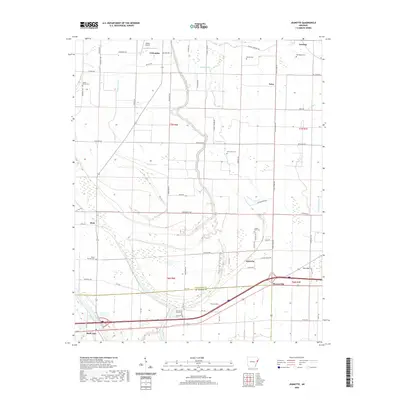
2020 Map of Jeanette
USGS Topo · Published 2020About this map
Jennette and Shearerville anchor the southern landscape of this Delta region, where the crossing of Interstate 40 and Highway 70 defines the modern transport corridor. The terrain is a complex network of wetlands and drainage, dominated by the meandering course of Blackfish Bayou and the smaller Wildcat Bayou. This environment is characterized by numerous small lakes and oxbows, including Holden Lake, Buck Lake, and Shell Lake at the southwestern corner. Historically oriented toward agricultural land use, the map reveals a scattering of small settlements and clusters such as Dixie, Lansing, and Crittenden. Family-named landmarks and local roads like Bings Store Rd and Johnny Holmes Rd reflect a deeply rooted rural community. Genealogists will find a high density of rural cemeteries throughout the quadrangle, from Mount Beulah Cem in the northwest to Pilgrim Rest Cem near the center, marking the sites of community congregations and family plots across the alluvial plain.
Find a feature on this map
69 named features on this map. Tap any name to fly to it.
Don’t see what you’re looking for? This feature index may not catch every label — zoom into the map to look around manually.
Map Details
Editions of this 2020 Jeanette Map
This is the sole edition of this map. No revisions or reprints were ever made.
Other maps of this area

1939 · Edmondson
USGS Topo · 1:62,500

1940 · Deckerville
USGS Topo · 1:62,500

1940 · Princedale
USGS Topo · 1:62,500

1940 · Whitmore
USGS Topo · 1:62,500

1953 · Memphis
USGS Topo · 1:250,000

1954 · Edmondson
USGS Topo · 1:62,500

1956 · Memphis
USGS Topo · 1:250,000

1956 · Whitmore
USGS Topo · 1:62,500

1956 · Princedale
USGS Topo · 1:62,500

1957 · Deckerville
USGS Topo · 1:62,500