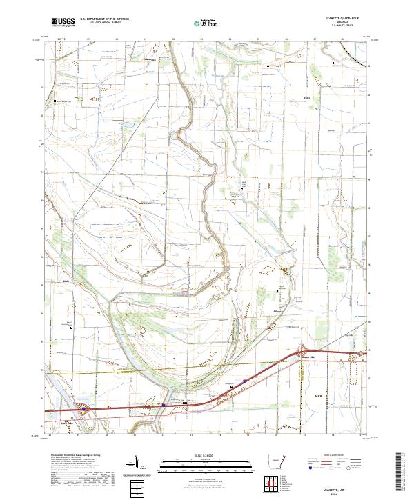
2024 Map of Jeanette
USGS Topo · Published 2024About this map
Blackfish Bayou winds through the heart of this Arkansas delta landscape, defining the local drainage and topography between Crittenden and the St. Francis County line. The settlement pattern is characterized by small rural communities like Jennette, Dixie, and Shearerville, often situated near significant water bodies such as Holden Lake or along the established corridors of the local road network. The area’s history is preserved in several rural burial grounds, including Pilgrim Rest Cem and Macedonia Cem, which serve as important markers for genealogists tracing local families. Transportation infrastructure ranges from the small Stokes Airport in the north to the more modern thoroughfares crossing the southern portion of the quadrangle near Shell Lake. This agricultural terrain shows the persistent influence of the bayou system on land use and settlement placement across this part of the Mississippi Alluvial Plain.
Find a feature on this map
64 named features on this map. Tap any name to fly to it.
Don’t see what you’re looking for? This feature index may not catch every label — zoom into the map to look around manually.
Map Details
Editions of this 2024 Jeanette Map
This is the sole edition of this map. No revisions or reprints were ever made.
Other maps of this area

1939 · Edmondson
USGS Topo · 1:62,500

1940 · Deckerville
USGS Topo · 1:62,500

1940 · Princedale
USGS Topo · 1:62,500

1940 · Whitmore
USGS Topo · 1:62,500

1953 · Memphis
USGS Topo · 1:250,000

1954 · Edmondson
USGS Topo · 1:62,500

1956 · Memphis
USGS Topo · 1:250,000

1956 · Whitmore
USGS Topo · 1:62,500

1956 · Princedale
USGS Topo · 1:62,500

1957 · Deckerville
USGS Topo · 1:62,500