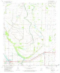
1981 Map of Jeanette
USGS Topo · Published 1982About this map
Blackfish Bayou and its winding tributaries dominate this 1980s landscape of eastern Arkansas, where the alluvial plain of the Delta is crisscrossed by drainage ditches and bayous. The map captures the agricultural and rural character of the border between Crittenden and St. Francis counties. Small communities like Jeanette and Shearerville are central to the area, while the historical Old Military Road cuts across the southern portion of the sheet, providing a tangible link to 19th-century transit routes.
Find a feature on this map
36 named features on this map. Tap any name to fly to it.
Don’t see what you’re looking for? This feature index may not catch every label — zoom into the map to look around manually.
Map Details
Editions of this 1981 Jeanette Map
2 editions found
Other maps of this area

1939 · Edmondson
USGS Topo · 1:62,500

1940 · Deckerville
USGS Topo · 1:62,500

1940 · Princedale
USGS Topo · 1:62,500

1940 · Whitmore
USGS Topo · 1:62,500

1953 · Memphis
USGS Topo · 1:250,000

1954 · Edmondson
USGS Topo · 1:62,500

1956 · Memphis
USGS Topo · 1:250,000

1956 · Whitmore
USGS Topo · 1:62,500

1956 · Princedale
USGS Topo · 1:62,500

1957 · Deckerville
USGS Topo · 1:62,500