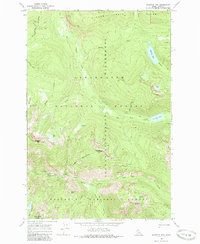
1966 Map of Jeanette Mountain
USGS Topo · Published 1986About this map
Jeanette Mtn stands at the center of this 1960s survey, marking a significant transition point within the Selway-Bitterroot Wilderness. The landscape is defined by the intersection of the Clearwater National Forest and the Nez Perce National Forest, with an indefinite national forest boundary meandering through the high ridges. This era reflects a period of established wilderness management where the primary human footprint is the extensive Pack Trail network, which provides the only access to remote alpine features like Hidden Lake, Big Sand Lake, and Corky Lake. High-altitude terrain features such as Horse Heaven Meadows and Goat Heaven Peaks illustrate the summer range and topographical complexity of this portion of the Idaho backcountry. The drainage patterns of the East Fork Moose Creek and Big Sand Creek dictate the movement of travelers and wildlife through these protected forests.
Find a feature on this map
26 named features on this map. Tap any name to fly to it.
Don’t see what you’re looking for? This feature index may not catch every label — zoom into the map to look around manually.
Map Details
Editions of this 1966 Jeanette Mountain Map
2 editions found
Other maps of this area

1901 · Hamilton
USGS Topo · 1:125,000

1911 · Lolo
USGS Topo · 1:250,000

1913 · Lolo
USGS Topo · 1:250,000

1956 · Hamilton
USGS Topo · 1:250,000

1959 · Hamilton
USGS Topo · 1:250,000

1960 · Hamilton
USGS Topo · 1:250,000

1964 · Hamilton
USGS Topo · 1:250,000

1964 · Tenmile Lake
USGS Topo · 1:24,000

1966 · Grave Peak
USGS Topo · 1:24,000
1966 · Wahoo Peak
USGS Topo · 1:24,000