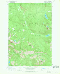
1966 Map of Jeanette Mtn.
USGS Topo · Published 1969About this map
Jeanette Mtn stands as a central high point in this 1966 topographic study, marking a landscape defined by the overlapping boundaries of the Selway-Bitterroot Wilderness, Clearwater National Forest, and Nezperce National Forest. The geography is characterized by high alpine basins and several small, high-elevation water bodies, including Jeanette Lake, Corky Lake, and Hidden Lake.
Find a feature on this map
28 named features on this map. Tap any name to fly to it.
Don’t see what you’re looking for? This feature index may not catch every label — zoom into the map to look around manually.
Map Details
Editions of this 1966 Jeanette Mtn. Map
2 editions found
Other maps of this area

1901 · Hamilton
USGS Topo · 1:125,000

1911 · Lolo
USGS Topo · 1:250,000

1913 · Lolo
USGS Topo · 1:250,000

1956 · Hamilton
USGS Topo · 1:250,000

1959 · Hamilton
USGS Topo · 1:250,000

1960 · Hamilton
USGS Topo · 1:250,000

1964 · Hamilton
USGS Topo · 1:250,000

1964 · Tenmile Lake
USGS Topo · 1:24,000

1966 · Grave Peak
USGS Topo · 1:24,000
1966 · Wahoo Peak
USGS Topo · 1:24,000