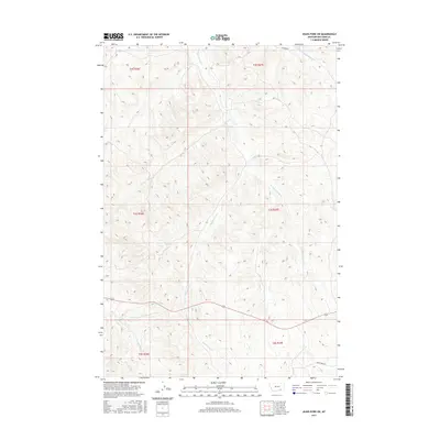
2017 Map of Jeans Fork SW
USGS Topo · Published 2017About this map
W Fork Tullock Cr and Middle Fork Tullock Cr define the northern drainage patterns of this high-plains landscape in Big Horn County. This 2017 survey details a network of ephemeral watercourses and topographic ridges that have shaped land use in the region for generations. The central portion of the map is marked by the winding path of Dipping Vat Cr, a name that suggests the area's ranching heritage and the practical infrastructure required for livestock management on the open range. To the south, Fork Reno Cr feeds into the local drainage system, while Reno Creek Rd provides the primary transit corridor across the undulating terrain. The Public Land Survey System grid, including townships like t3s r37e, provides a framework for understanding modern property boundaries and the historical division of Montana’s ranch lands.
Find a feature on this map
11 named features on this map. Tap any name to fly to it.
Don’t see what you’re looking for? This feature index may not catch every label — zoom into the map to look around manually.
Map Details
Editions of this 2017 Jeans Fork SW Map
This is the sole edition of this map. No revisions or reprints were ever made.
Other maps of this area

1894 · Rosebud
USGS Topo · 1:125,000

1901 · Rosebud
USGS Topo · 1:125,000

1954 · Hardin
USGS Topo · 1:250,000

1957 · Hardin
USGS Topo · 1:250,000

1958 · Hardin
USGS Topo · 1:250,000

1967 · Jeans Fork NW
USGS Topo · 1:24,000

1967 · Jeans Fork NE
USGS Topo · 1:24,000

1967 · Crow Agency NE
USGS Topo · 1:24,000

1967 · Crow Agency SE
USGS Topo · 1:24,000

1967 · Lodge Grass NE
USGS Topo · 1:24,000