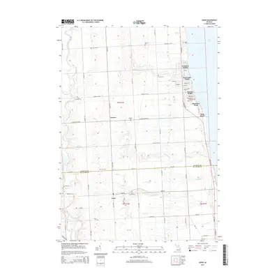
2014 Map of Jeddo
USGS Topo · Published 2014About this map
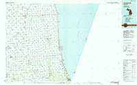
The Lake Huron shoreline defines the eastern edge of this Michigan landscape, where a series of residential developments like Lexington Heights, Great Lakes Beach, and Blue Water Beach sit atop the bluffs. Moving inland, the terrain transitions into a grid of agricultural lands and woodlots, bisected by the Sanilac Co St Clair Co line. The small settlement of Jeddo serves as a local hub near the southern border, while Amadore sits further north along Wildcat Rd.
Find a feature on this map
51 named features on this map. Tap any name to fly to it.
Don’t see what you’re looking for? This feature index may not catch every label — zoom into the map to look around manually.
Map Details
Editions of this 2014 Jeddo Map
This is the sole edition of this map. No revisions or reprints were ever made.
Other maps of this area

1954 · Flint
USGS Topo · 1:250,000

1958 · Flint
USGS Topo · 1:250,000
1961 · Ruby
USGS Topo · 1:24,000
1961 · Roseburg
USGS Topo · 1:24,000
1961 · Avoca
USGS Topo · 1:24,000
1961 · Lakeport
USGS Topo · 1:24,000
1961 · Jeddo
USGS Topo · 1:24,000
1963 · Croswell
USGS Topo · 1:24,000
1963 · Applegate
USGS Topo · 1:24,000
1984 · Croswell
USGS Topo · 1:100,000
Featured Places
- Lexington Heights, MI
- Grant Township, MI
- Lexington Township, MI
- Burtchville Township, MI
- Worth Township, MI