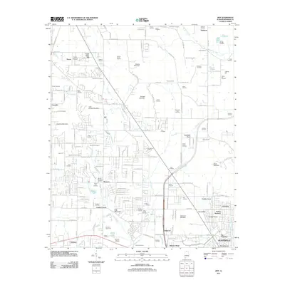
2011 Map of Jeff
USGS Topo · Published 2011About this map
Burwell Mountain and Quarter Mountain rise above a landscape defined by its numerous family-named burial grounds and small communities in the area northwest of Huntsville. The settlement pattern centers around Jeff, Monrovia, and Old Monrovia, where a dense network of residential streets like Douglass Rd NW and Blake Bottom Rd NW meets rural landmarks like the Madison County Dragway. The map is particularly notable for its high concentration of cemeteries, including the Fords Chapel Cemetery, Scruggs Cemetery, and Moore Cemetery, which offer valuable data points for local genealogy. Hydrological features such as Indian Creek, Vaughn Lake, and the winding Beaverdam Creek weave through the terrain, illustrating the drainage patterns that shaped early land use in Madison County.
Find a feature on this map
131 named features on this map. Tap any name to fly to it.
Don’t see what you’re looking for? This feature index may not catch every label — zoom into the map to look around manually.
Map Details
Editions of this 2011 Jeff Map
This is the sole edition of this map. No revisions or reprints were ever made.
Other maps of this area

1888 · Huntsville
USGS Topo · 1:125,000

1892 · Huntsville
USGS Topo · 1:125,000

1936 · Jeff
USGS Topo · 1:24,000

1936 · Capshaw
USGS Topo · 1:24,000

1936 · Madison
USGS Topo · 1:24,000

1936 · Meridianville
USGS Topo · 1:24,000

1936 · Fisk
USGS Topo · 1:24,000

1936 · Ardmore
USGS Topo · 1:24,000

1936 · Toney
USGS Topo · 1:24,000

1936 · Greenbrier
USGS Topo · 1:24,000